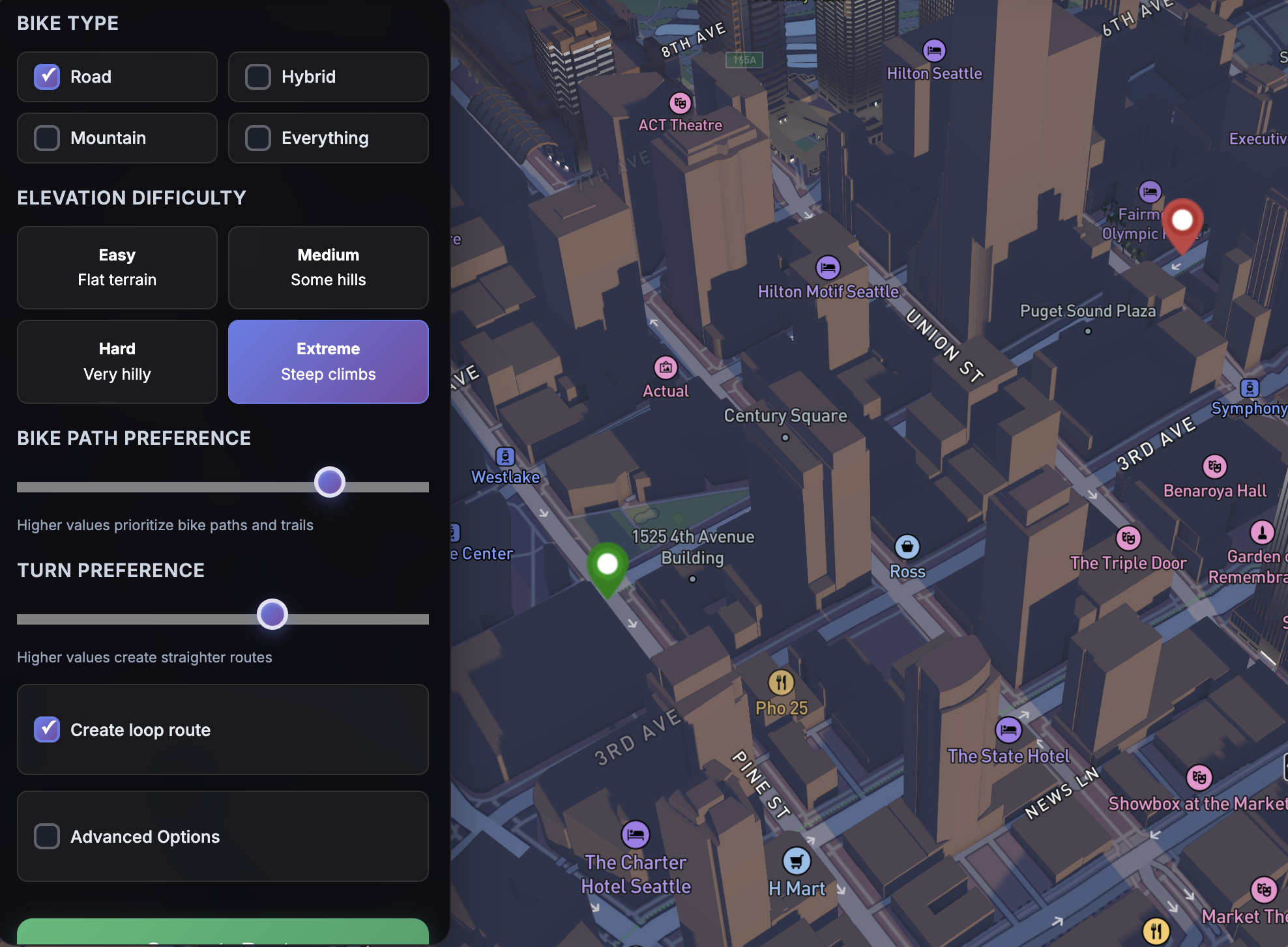
Pick a destination or a distance and we’ll build safe, scenic routes using real‑world data. Fine‑tune surfaces, turns, elevation, and loopback for your perfect ride.
RouteScout blends flexibility and control, so every ride matches your mood.
Set start/end points and we’ll build a bike‑friendly path with your preferred turn density and surfaces.
Pick a center and distance. We’ll find great landmarks within range and route you there and back.
Get a peek inside how RouteScout works. Tap the map to inspect graph nodes and nearby connections, great for route nerds and power users.
Prefer paved, gravel, or mixed? Choose what you ride on and exclude surface types you want to avoid.
Bias toward quieter residential streets and bike routes, away from busy arterials, so rides feel calmer.
Our cyclability setting prefers bike lanes, cycling‑exclusive paths, and quieter roads to keep rides enjoyable.
Pick your hill flavor—from flat and fast to steep and scenic, with a visual elevation profile.
Toggle public links, copy to clipboard, or download GPX for your device. It’s your route, share it your way.
Choose Direct, Landmark, or Node Explorer from a modern, mobile‑friendly interface.
Tell us your goals. Prefer bike lanes and quiet streets? Want fewer turns, especially left turns? Love hills or hate them? RouteScout adapts.
Get from A → B beautifully. Preview the 3D route with elevation, copy a public link, or export GPX, then get moving.
Connect Strava to see your heatmap in RouteScout — free. Connect with Strava
I’m building a way to use your ride history to shape routes, including preferring roads you haven’t ridden yet.